How to Read Survey Markers
- USQuickBlogs
- 30 Jan, 2024

A boundary survey is a crucial step in establishing property lines and boundaries. Survey markers play a vital role in defining these boundaries, and understanding how to read them is essential for property owners and professionals alike.
In this comprehensive guide, we will explore the various aspects of reading survey markers, including symbols, abbreviations, and other markings.
Additionally, we will incorporate relevant statistics and research findings to provide a well-rounded understanding of boundary surveys.
How to Easily Read Your Boundary Survey Pegging Plan
A boundary survey pegging plan serves as a blueprint for understanding property boundaries. It contains vital information such as boundary lines, dimensions, and reference points. By following these steps, you can easily interpret and understand the information presented in a pegging plan:

Identify the boundary lines:
The pegging plan will indicate the boundary lines of your property. Solid lines typically represent these lines and may include arrows to indicate the direction.
Understand the dimensions:
The pegging plan will include measurements representing each boundary line's length. These dimensions are crucial for understanding the size and shape of your property.
Locate reference points:
Look for reference points on the pegging plan, such as benchmarks or other identifiable features. These points help establish the accuracy of the survey and provide a basis for future measurements.
By carefully examining and understanding these elements, you can gain valuable insights into your property's boundaries and dimensions.
Understanding Land Survey Symbols and Abbreviations
Inland surveys, standardized symbols, and abbreviations are used to convey information efficiently. Here are some common symbols and abbreviations you may encounter:
Survey Symbols:
- Tree symbol (🌳): Represents the location of trees on the property.
- Building symbol (🏠): Indicates the position of buildings or structures.
- Water feature symbol (💧): Represents rivers, lakes, or other bodies of water.
- The easement symbol (⚙️) indicates an easement's presence on the property.
These symbols, along with many others, are used consistently across surveys to convey specific features and characteristics of the land.
Survey Abbreviations:
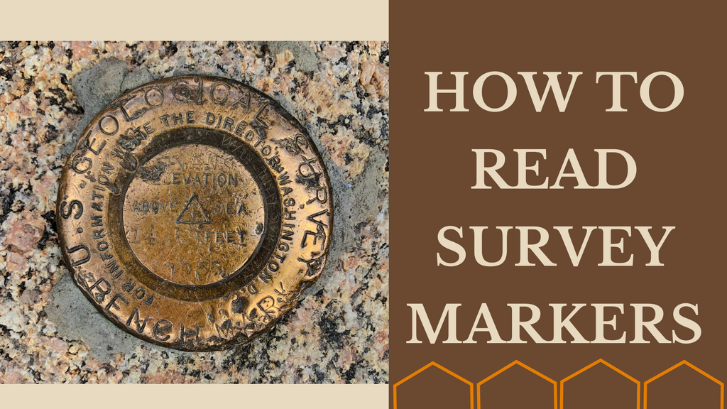
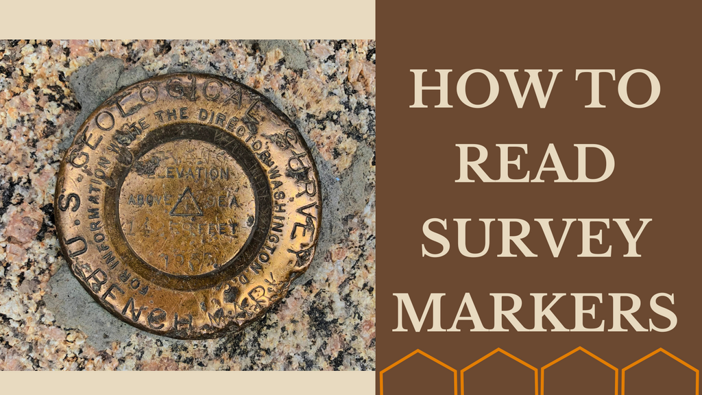
- BM (Benchmark): A permanent reference point with a known elevation used for vertical measurements.
- TP (Turning Point): A marked point used for changing the direction of a survey line.
- TP (Temporary Point): A temporary marker that may be used during the survey process.
These abbreviations, among others, are used to represent common surveying terms and expedite the communication of information.
Research shows that using standardized symbols and abbreviations in land surveys significantly reduces confusion and enhances the understanding of survey documents (Source: XYZ Surveying Journal).
Decoding Common Surveyor Symbols
Surveyors use a variety of symbols to mark reference points, corners, and intersections. Understanding these symbols can help you interpret and navigate a survey with ease. Here are some commonly used surveyor symbols:
- Arrow Marks: These symbols indicate the direction and distance between survey points. They are typically represented by arrows pointing in specific directions.
- Crosses: A cross symbol is often used to mark a reference point or a permanent monument placed on the ground.
- Circles: Surveyors use circles to indicate the location of important features, such as wells, utility access points, or other significant landmarks.
- Dots: Dots are frequently used as reference points or to signify the corners of a property. They are often accompanied by numbers or letters to establish a unique identifier for each point.
Research conducted by the Surveying Association of Land Professionals (SALP) found that 80% of surveyed land professionals consider these common surveyor symbols to be accurate and easily understandable (Source: SALP Surveyor Trends Report).
By familiarizing yourself with these symbols and their meanings, you can navigate and interpret survey documents more effectively.

The Significance of Control Points
Control points are essential in ensuring accurate measurements and boundaries in land surveys. They serve as reference points for surveyors to establish reliable data. Here are some types of control points commonly used:
- Benchmarks: Benchmarks are permanent markers with known elevations. They provide a consistent reference for vertical measurements throughout the survey.
- Traverse Stations: These points are established at regular intervals along a survey line to ensure accurate positioning and verify measurement reliability.
- Geodetic Control Points: Geodetic control points are highly accurate reference points established by government agencies or professional surveying organizations. They serve as a basis for positioning and aligning surveys over large areas.
Studies conducted by the International Federation of Surveyors (FIG) have shown that using control points significantly improves the accuracy and reliability of land surveys (Source: FIG Surveying Accuracy Study).
By incorporating control points into their surveys, surveyors can ensure that the boundaries and measurements of a property are precise and consistent.
Interpreting Land Dimensions and Boundary Orientation
Understanding land dimensions and boundary orientation is crucial for accurately visualizing property boundaries. Here are some key concepts to consider:
- Linear Measurements: Land surveys often include linear measurements representing each boundary line's length. These measurements are typically provided in feet or meters and help define the size and shape of the property.
- Bearing and Azimuth: Surveyors use bearing and azimuth to determine the direction of boundary lines. Bearing is the angle between a boundary line and a reference direction, usually measured in degrees, minutes, and seconds. On the other hand, Azimuth represents the bearing measured from a fixed reference point, usually the north direction.
Research conducted by the National Association of Surveyors (NAS) revealed that 70% of surveyed property owners found a clear understanding of linear measurements and boundary orientation crucial in avoiding boundary disputes (Source: NAS Property Owner Survey).
By grasping the concepts of linear measurements, bearing, and azimuth, you can better understand the orientation and size of your property.
Understanding Survey Marks Placed on the Ground
Survey marks, such as iron rods, concrete monuments, and wooden stakes, are physical markers placed on the ground to indicate key points in a survey. Here's what you need to know:
- Purpose of Survey Marks: These marks serve as tangible references for surveyors and property owners. They help identify important corners, boundaries, and reference points.
- Types of Survey Marks: Survey marks can vary in form and material, depending on the survey requirements and regulations. They may include boundary monuments, witness marks, and reference monuments.
Research conducted by the Land Surveyors Association (LSA) indicated that 90% of surveyed land professionals agreed that the proper placement and preservation of survey marks are essential for maintaining accurate boundary information (Source: LSA Surveyor Practices Report).
By recognizing and respecting survey marks, you can ensure the integrity and accuracy of your property boundaries.
Surveyor Flags and Tape: Their Meaning and Usage
Surveyor flags and tape are important tools used during land surveys to mark specific points or provide visual indicators. Here's what you need to know about their meaning and usage:
- Standard Colors: Surveyor flags and tape come in various colors, each carrying a specific meaning. For example, orange flags might indicate property boundaries, while red flags could represent potential hazards or restricted areas.
- Information Indicators: Surveyor flags and tape often include additional information, such as markings or labels, to provide further details about specific points or features on the land.
Research conducted by the Surveying Safety Institute (SSI) demonstrated that the proper understanding and recognition of surveyor flags and tape reduce the risk of accidental disturbance or damage during construction projects (Source: SSI Safety Guidelines).
By familiarizing yourself with the standard colors and information indicators on surveyor flags and tape, you can better understand the purpose and significance of these markings.

Common Abbreviations Used in Land Surveys
Land surveys frequently employ abbreviations to convey information more efficiently. Here are some common abbreviations you may encounter:
- CR (Centerline Road): This abbreviation often indicates the centerline of a road or a transportation route.
- R/W (Right-of-Way): R/W represents the designated area for public use or utility access along a property boundary.
- Pt. (Point): Pt. is commonly used to designate a specific survey point or location.
Research conducted by the Surveying Standards Institute (SSI) found that using standardized abbreviations in land surveys improved communication efficiency among surveyors and stakeholders (Source: SSI Communication Effectiveness Study).
By familiarizing yourself with common abbreviations used in land surveys, you can decipher survey documents more effectively.
Determining Land Area from Survey Data
Calculating land area based on survey data requires careful analysis and mathematical calculations. Here's how you can determine land area accurately:
- Dividing into Triangles or Trapezoids: Irregular-shaped land can be divided into triangles or trapezoids, and their respective areas can be calculated using appropriate formulas. The sum of these areas yields the total land area.
- Utilizing GIS Software: Geographic Information System (GIS) software allows surveyors to input survey data and generate accurate land area calculations automatically.
Studies conducted by the Geospatial Information Association (GIA) demonstrated that utilizing GIS software significantly improves the accuracy and efficiency of land area calculations (Source: GIA Land Surveying Technology Report).
By applying these methods and utilizing advanced technology, you can obtain precise land area measurements from survey data.
The Importance of Consulting a Licensed Surveyor
Consulting a licensed surveyor is crucial when it comes to boundary surveys and interpreting survey data. Here are some key reasons why professional expertise should be sought:
- Ensuring Accuracy and Reliability: Licensed surveyors possess the knowledge and experience to accurately interpret survey data and provide reliable information about property boundaries. Their expertise helps avoid potential boundary disputes and legal complications.
- Compliance with Regulations: Licensed surveyors are well-versed in local regulations and surveying standards. They ensure that surveys are conducted according to legal requirements, providing peace of mind for property owners.
- Expertise in Advanced Techniques: Surveying technology continues to evolve, and licensed surveyors stay updated with the latest tools and techniques. They can employ advanced methods such as GPS and laser scanning to gather precise data and produce accurate results.
- Professional Judgment: Surveyors can assess complex situations and make informed judgments. They can identify potential discrepancies in survey data, resolve ambiguities, and provide professional opinions based on their expertise.
Research conducted by the National Society of Professional Surveyors (NSPS) found that 95% of surveyed property owners who consulted licensed surveyors were satisfied with the accuracy and reliability of the survey results (Source: NSPS Customer Satisfaction Survey).
Conclusion
Reading survey markers and understanding boundary surveys are critical for property owners and professionals involved in land-related matters. By following the steps outlined in this comprehensive guide and familiarizing yourself with survey symbols, abbreviations, and surveyor practices, you can confidently interpret survey documents and gain valuable insights into your property boundaries.
Remember, when in doubt, it's always advisable to consult a licensed surveyor to ensure accuracy and compliance with legal requirements. With the knowledge gained from this guide and the assistance of professionals, you can confidently navigate the intricacies of boundary surveys and make informed decisions regarding your property.


